LAND ENTERPRISE
Los Angeles, CA

Los Angeles, CA
info
- Home
- Residential Real Estate
- Interstate Parcels
- Christmas Valley, Oregon land For $14,900
- Battle Mountain, Nevada For $19,500
- 40 Acres Near Winnemucca, Nevada For $17,000.
- 41.19 Acres Near Lovelock, Nevada For $16,500.
- 13.33 Acres Near Saint Johns, Arizona For $9,750.
- 2.5 Acres Granado, Arizona For $9,000
- 20 Acres Near Castle Butte, Arizona For $16,000.
- 4.5 Acres in Apache County, Arizona For $5,800
- 4.6 Acres in Apache County, Arizona Land For $4,900
- 40 Acres Near Deming, New Mexico For $23,500
- 10.12 Acres Pecos County, Texas Land For $7,990
- 0.46 Acres in Horseshoe Bend Arkansas For $10,000.
- Vacant Lot, Ozark Acres, Sharp County, Arkansas Land For $10,000
- 3006 sq. ft.Bent Tree Harbor, Missouri Homesite For $4,500.
- 0.27 Acres Candlewood Lakes, Tennessee Homesite For $9,500.
- 0.55 Acres in Jasper, Georgia For $16,500
- 4.9 Acres in Allegany County, New York For $15,000
- Available Parcels
- 5 acres near Mt Waterman for $9,500
- 19.81 acre Land in Fairmont for $75,000.
- 0.13 acres in California City for $9500
- 0.16 acre double lot in Lancaster for $25,000.
- 9.9 acres in Juniper Hills,Calif for $17,900.
- 0.2 acres on Eva Terrace at Flora Ave in L. A. for $22,500
- 4.9 acres Near Mt.Waterman,Calif. for $9500
- 40.6 acres Soledad Canyon Rd, Acton,Ca For $145,000
- Lake Elsinore Land For $12,000
- Leona Valley Land For $25,000
- Oak Run, California Homesite For $79,000
- Tipton Way Land For $49,000
- 2.56 acres in Roosevelt, Calif for $6,500
- 2.5 acres in Fairmont for $9,500.
- 0.28 acres in Malibu for $79,000
- 3093 Sq.Ft Lot in Lancaster for $15,000.
- Available Real Estate
- About Us
- Contact Us
Oak Run, California Homesite For $79,000
Shasta County APN# 097-190-006-000
This 41.89 acre parcel is a vacant land in Oak Run, California; on Western Whitehouse/Teahouse Way. Oak Run is a small unincorporated community 23 miles (37 km) east of Redding in California.The nearest city is Redding. The nearest neighbor;26980 Western Whitehouse Way; Oak Run, CA 96069.The GPS coordinates are; 40.684495(Lat) & -122.044823.The elevation is 1350-1450 feet. Oak Run started as a mining area for quartz in 1860.The Homestead Act in 1862was passed and so a steady of stream of Pioneers came to the area. They filed claims or bought land in the hot, beautiful country of present day Oak Run. Old Oak Run Road was a public road to begin with. It pretty much follows the tracks cut by Wells Fargo Stages. Then, around 1877 the post Office was established. The first school house was built in 1872. By the early 1900's the enrollment was around 35 pupils. Tragically the school burned in 1936.Due to this emergency the church was fixed up so that school could be held there. Finally, in 1953 the Oak and Phillips district lapsed and they formed a joint district. In 1960 the school was built at its present location. This parcel is near the Oak Run Library and the town of Oak Run in Shasta County.
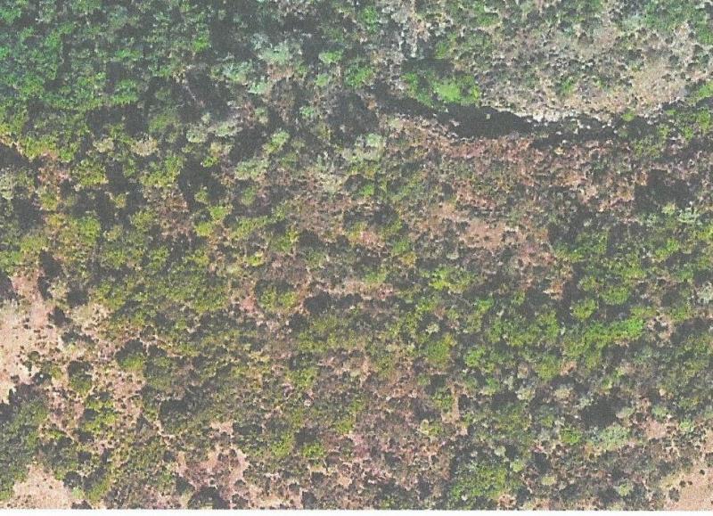
Aerial view of the parcel.
Copyright (C) 2012 Land Enterprise. All rights reserved
Webdesign: Dynamic Media Group
Los Angeles, CA
info